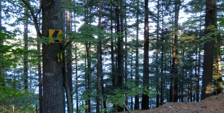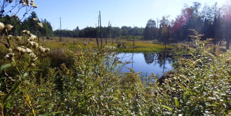


Connecting Horseshoe Lake to Massawepie Lake you will find a backwoods mountain biking road that offers an enjoyable cruise through a mix of dense forests as it passes the back side of Mt. Arab to connect two unique and beautiful recreation trail networks.
Getting there
Since this is a “connector trail,” you can choose your starting point to be at either Massawepie or Horseshoe.
To Horseshoe: From the intersection of NYS Routes 3 & 30 (on Park Street near Stewart’s) in Tupper Lake, head west until you reach the intersection Park Street and Wawbeek Avenue (NYS Route 30). Turn left and follow Route 30 south for 8.7 miles to County Route 421. Turn right.
After 1.6 miles, Route 421 will turn left and continue for another 3.9 miles. Here you will find a variety of parking areas to choose from depending on how long or short you would like to make your trip. These include the decent sized parking area and overlook on your right, Low’s Lower Dam a little further up with an access road on your left, or at the railroad tracks crossing about a mile up.
To Massawepie: From the intersection of NYS Routes 3 and 30 (on Park Street near Stewart’s) in Tupper Lake, follow Route 3 down Mill Street, then turn right onto Lake Street and follow Route 3 for 11.5 miles to the Massawepie Boy Scout Camp. Turn left on to Massawepie Road when you see the camp sign.
A little ways up you will begin to see the Boy Scouts Camp and need to go left through the camp. Please use causing and note, there are a variety of parking areas along this road. During camp season (June 15 - September 1) some of the first parking areas will be closed to the public. However, from September 1 - June 14 all of these parking areas and the related hiking trails are open. Signs at the parking areas will indicate if they are closed or open.
Gravel biking
The trip from Horseshoe Lake to Massawepie (or vice versa) follows along a remote logging road that meanders through a variety of mixed forests, past tranquil bogs and on to beautiful lakes on both end. The majority of the road is well marked by snowmobile signs - as this is a popular snowmobile route in the winter months. It involves a variety of moderate hills in both directions, however your gain will be less challenging if you start from Horseshoe and head towards Massawepie. Use caution that you stay on the road and do not head off on any of the different logging roads that connect to and from the Massawepie Road.
Length One-Way: 10-15 miles / 16-24 kilometers (depending on where you choose to begin and end your trip.)
Length Round-Trip: 20-30 miles / 32-48 (kilometers depending on where you choose to begin and end your trip.)
Elevation gain: Roughly 600 feet
Difficulty: Beginner to Intermediate (it does boast a considerable amount of hills)


Packages and Promotions
Valid Jan. 20 - Jan. 20
Valid Jan. 20 - Jan. 20
Pet Getaway
Voco Saranac Lake
Your dog deserves an Adirondack getaway too. Book our pet friendly hotel near Lake Placid welcomes every member of your crew. Book our Pet Package and enjoy a dog friendly room with pet fees included.
Valid
Valid Dec. 8 - May. 21
Thursday Meal Deal
Raquette River Brewing
Thursday Deal at Raquette River Brewing! Every Thursday, head to Raquette River Brewing for a deal you won't want to miss. Spend $14 at LJ Food Truck and/or Fusion Street and receive a FREE drink token for your next round at the brewery. This special...
Valid Apr. 16 - May. 22
Valid Dec. 9 - May. 22
Thursday Meal Deal
Raquette River Brewing
Thursday Deal at Raquette River Brewing! Every Thursday, head to Raquette River Brewing for a deal you won't want to miss. Spend $14 at LJ Food Truck and/or Fusion Street and receive a FREE drink token for your next round at the brewery. This special...
Valid Jan. 20
Valid Jan. 20 - Jan. 20
Stay and Dine
Voco Saranac Lake
Receive a 50 dollar credit per stay to use in our Boathouse Saranac Lake Pub. Enjoy an exceptional dining experience with unparalleled views great food and craft beers in a friendly and relaxed environment.
Valid
Valid Oct. 31 - Apr. 29
Buy One, Get One Bloody Mary Sundays!
Raquette River Brewing
Sunday Funday: BOGO Deal at Raquette River Brewing. Join us every Sunday for a delicious deal you won't want to miss! Buy one, get one FREE on our famous Bloody Marys and Bloody Caesars! Made with our secret RRB Bloody Mix, these cocktails are the...
Valid May. 25 - Jun. 7
Valid Mar. 9 - Jun. 7
Complementary Breakfast at The Enclave
The Enclave
From May 28 - June 8, enjoy an exclusive special: Complementary Breakfast! Just a 3-minute walk to the Rail Trail connecting Tupper Lake & Lake Placid Easy access to the Tupper Triad & Junction Pass Trail Sip local craft brews at Raquette River...