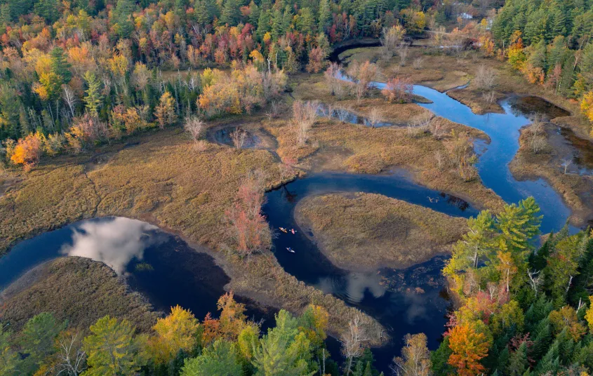


The trail to Stony Creek Ponds is a historical canoe carry route called Indian Carry, and its current form was built by the Adirondack Mountain Club, with the land being transferred to the state by the Adirondack Land Trust.
Key takeaways
- Distance: 1.0 mile round trip
- Elevation gain: 125 feet
Hiking to Stony Creek Ponds
From the parking area cross Route 3, carefully. Once on the trail, start a mellow hike through the mixed forest which gets very little sunlight in certain areas. The boardwalks along this trail, which is considered a canoe carry, can be very slippery. The terrain is very easy and the only one downhill section at the very end is all the elevation change you will really have. The views out over the pond are fantastic.
Stony Creek Ponds in the winter
This could make for a nice little cross-country ski trip in the winter.
Discover more trails in Tupper Lake
Looking to find some more trails to hike in Tupper Lake? With endless mountains, lakes, and waterfalls to visit in the Adirondacks, there are always more trails to discover!
Paddling
Paddling Stony Creek Ponds is part of the Tupper Lake Paddling Triad, and a must-do for anyone looking to get out on the water in the Adirondacks. Views of Stony Creek Mountain, and access to the Raquette River via Stony Creek, make this a great destination.
How to get there
From the intersection of Route 3 and Route 30 in the Village of Tupper Lake follow Route 3 toward Saranac Lake. Continue for 9 miles to the small trailhead on the right, parking is on the left. There is no trail sign for Stony Creek Ponds, this is a portage trail. Locate the parking for Indian Carry, the trail is directly across the road between two guard rails.


Packages and Promotions
Valid
Valid Oct. 31 - Apr. 29
Every week on Sunday.
Buy One, Get One Bloody Mary Sundays!
Raquette River Brewing
Sunday Funday: BOGO Deal at Raquette River Brewing. Join us every Sunday for a delicious deal you won't want to miss! Buy one, get one FREE on our famous Bloody Marys and Bloody Caesars! Made with our secret RRB Bloody Mix, these cocktails are the...
Valid Jan. 20 - Mar. 30
Valid Jan. 20 - Mar. 30
Titus Mountain Ski Package
Voco Saranac Lake
Enjoy your stay at the award winning voco Saranac Lake which includes two adult lift tickets at Titus Mountain Family Ski Center. Additional complimentary amenities include ski storage at the hotel and preferred parking at the mountain.
Valid Jan. 20 - Jan. 20
Valid Jan. 20 - Jan. 20
Stay and Dine
Voco Saranac Lake
Receive a 50 dollar credit per stay to use in our Boathouse Saranac Lake Pub. Enjoy an exceptional dining experience with unparalleled views great food and craft beers in a friendly and relaxed environment.
Valid
Valid Jan. 15 - Mar. 28
Every week on Friday.
Fish Fry Fridays at P-2's Irish Pub
P-2's Irish Pub
Every Friday, head to P-2's Irish Pub in Tupper Lake for the best fish fry in town. Enjoy perfectly crispy, golden fish paired with your favorite sides and a cold drink in a warm and welcoming atmosphere. Where: P-2's Irish Pub, 31 Main Street, Tupper...
Valid Jan. 20 - Jan. 20
Valid Jan. 20 - Jan. 20
Pet Getaway
Voco Saranac Lake
Your dog deserves an Adirondack getaway too. Book our pet friendly hotel near Lake Placid welcomes every member of your crew. Book our Pet Package and enjoy a dog friendly room with pet fees included.
Valid
Valid Dec. 8 - May. 21
Every week on Thursday.
Thursday Meal Deal
Raquette River Brewing
Thursday Deal at Raquette River Brewing! Every Thursday, head to Raquette River Brewing for a deal you won't want to miss. Spend $14 at LJ Food Truck and/or Fusion Street and receive a FREE drink token for your next round at the brewery. This special...