


44.134236, -74.646023
Lows Overlook
Location:
Route 421, Piercefield
Additional Info:
View Brochure
Website:
Email:
Phone:
(518) 359-3328
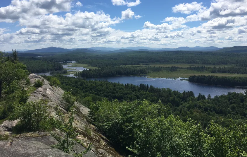
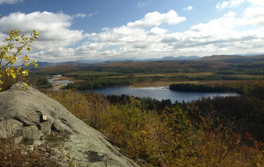
The hike to Lows Overlook (aka Lows Ridge or Hitchins Pond Overlook) ends in a stunning view from a summit cliff. Overlooking the breathtaking Bog River, many Wilderness Areas, and Lows Lake, the views here will leave you inspired to explore this area further.
Key takeaways
- Distance: 6.5 miles round trip
- Elevation gain: 620 feet
- Overlook elevation: 2,170 feet
- Hike includes a road walk and trail junctions
Hiking to Lows Overlook
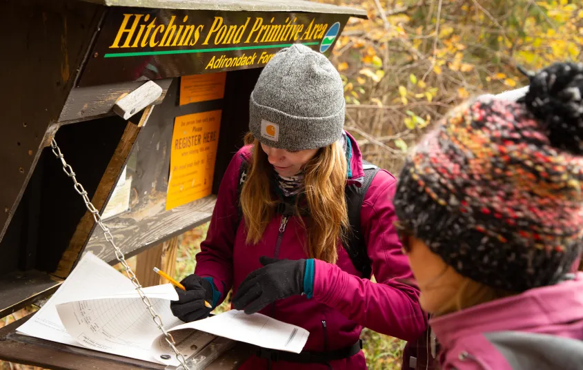
This hike starts along a forest road. You may hike, bike, or ski this. The road is mostly flat and passes by what is called Hitchens Marsh on your left. This marsh is a massive expanse of land. The road comes to Lows Upper Dam at Hitchins Pond, which is a very scenic and historic location.
The trail to Lows Overlook (or Hitchins Pond Overlook/Lows Ridge, as it's sometimes called) is located on the right side of the road near the remnants of a couple buildings. No bikes are allowed on this trail; they must be left on the road. The trail is moderate and has one fairly steep section. The trail sweeps around the base and comes up the backside of the overlook along a long rock spine. To the northeast side of the spine there is a memorial to Abbot Augustus Low (d. 1912), a Brooklyn native who owned around 32,000 acres of land around the Bog River Flow.
Lows Overlook in the winter
The approach to this ridge would make for a good cross-country ski, but bear in mind that the final part is not skiable, and you will need to have snowshoes and/or microspikes. This is a long and isolating hike in the winter, so be prepared for all conditions.
Discover more trails near Tupper Lake
Does Lows Overlook/Ridge sound amazing, but a little more than you want to tackle right now? No need to stress, with endless mountains, lakes, and waterfalls to visit in the Adirondacks, we are sure we can help you discover a trail that’s just right!
How to get there
From the intersection of Route 30 and Route 3 in Tupper Lake, follow Route 30 toward Long Lake. Continue for 9.1 miles to Route 421 on your right. Turn down 421 and continue for 6.5 miles to the old railroad station on Horseshoe Lake. Turn left on a gravel road once you've reached the end. Cross the railroad tracks on a secondary road and continue for 0.9 miles to a gated road on the left, park here away from the gate. You will have to hike, mountain bike, or ski to the trailhead for Lows Overlook.


Websites
- https://www.dec.ny.gov/lands/75295.html
Packages and Promotions
range
Valid Jan. 20 - Jan. 20
Valid Jan. 20 - Jan. 20
Pet Getaway
Voco Saranac Lake
Voco Saranac Lake
Your dog deserves an Adirondack getaway too. Book our pet friendly hotel near Lake Placid welcomes every member of your crew. Book our Pet Package and enjoy a dog friendly room with pet fees included.
package
Other
range
Valid Jan. 20 - Mar. 30
Valid Jan. 20 - Mar. 30
Titus Mountain Ski Package
Voco Saranac Lake
Voco Saranac Lake
Enjoy your stay at the award winning voco Saranac Lake which includes two adult lift tickets at Titus Mountain Family Ski Center. Additional complimentary amenities include ski storage at the hotel and preferred parking at the mountain.
package
Activities and Attractions, Ski
recurring
Valid
Valid Dec. 8 - May. 21
Every week on Thursday.
Thursday Meal Deal
Raquette River Brewing
Raquette River Brewing, Fusion Pizza - Food Truck, LJ's Food Truck
Thursday Deal at Raquette River Brewing! Every Thursday, head to Raquette River Brewing for a deal you won't want to miss. Spend $14 at LJ Food Truck and/or Fusion Street and receive a FREE drink token for your next round at the brewery. This special...
promotion
Dining Deals
1
week
Th
recurring
Valid
Valid Oct. 31 - Apr. 29
Every week on Sunday.
Buy One, Get One Bloody Mary Sundays!
Raquette River Brewing
Raquette River Brewing
Sunday Funday: BOGO Deal at Raquette River Brewing. Join us every Sunday for a delicious deal you won't want to miss! Buy one, get one FREE on our famous Bloody Marys and Bloody Caesars! Made with our secret RRB Bloody Mix, these cocktails are the...
promotion
Dining Deals
1
week
Su
recurring
Valid
Valid Jan. 15 - Mar. 28
Every week on Friday.
Fish Fry Fridays at P-2's Irish Pub
P-2's Irish Pub
P-2's Irish Pub
Every Friday, head to P-2's Irish Pub in Tupper Lake for the best fish fry in town. Enjoy perfectly crispy, golden fish paired with your favorite sides and a cold drink in a warm and welcoming atmosphere. Where: P-2's Irish Pub, 31 Main Street, Tupper...
promotion
Dining Deals
1
week
Fr
range
Valid Jan. 20 - Jan. 20
Valid Jan. 20 - Jan. 20
Stay and Dine
Voco Saranac Lake
Voco Saranac Lake
Receive a 50 dollar credit per stay to use in our Boathouse Saranac Lake Pub. Enjoy an exceptional dining experience with unparalleled views great food and craft beers in a friendly and relaxed environment.
package
Activities and Attractions, Dining Deals
Discover More
Totally Tupper Lake
Hike and Bike to Lows Overlook
Last fall I woke up on a brisk morning to venture out on a hiking and biking adventure just outside of Tupper Lake. I really like exploring new places, so when asked to bike into Hitchins Pond to hike up Lows Overlook, I happily accepted. This is a...
