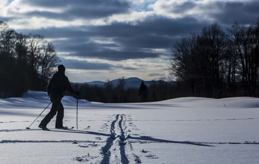

Remote cross-country skiing in the Round Lake Wilderness Area. The ski to Lows Lower Dam is easier, while continuing to Big Trout Lake will include some hills and more difficult terrain.
Key takeaways
- Distances: 3 miles for Lows Lower Dam and 6 miles for Big Trout Lake, round trip
- Elevation gain: 160 feet for Lows Lower Dam and 525 feet for Big Trout Lake, round trip
Cross-country skiing to Big Trout Lake
Once you arrive at the parking area, which is also considered a snowmobile staging area, you can start your ski. The entire route follows a snowmobile trail, but only certain areas get the heavy traffic, so the conditions can be a bit mixed.
Along the snowmobile trail expect hard-packed conditions and in some cases may be a bit icy. The road is very flat as it passes along Horseshoe Lake and quickly comes to the side road that leads to Lows Lower Dam. This section of road is ever so slightly downhill, not so much that you can get gain any speed, but the kick and glide is nice. You will be slightly lower than where you started. This is a good spot to turn around if you find that you have had enough, the trail gets a bit more aggressive as you continue on. The views out over the Bog River are very nice.
To get to Big Trout Lake you need to cross over the dam and gain the trail on the opposite side. The trail now is much narrower, even for a snowmobile trail. The trail remains moderate for a while but soon starts to climb to a ridgeline for an unnamed small hill to your left. Once on the ridge you will have a short distance on moderate terrain before a modest hill is in front of you. The hill starts out fairly gentle but gets slightly steeper as you approach the shore of Big Trout Lake. The view out over the lake is very nice.
How to get there
From the intersection of Route 30 and Route 3 in Tupper Lake, follow Route 30 toward Long Lake. Continue for 9.1 miles to Route 421 on your right. Turn down 421 and continue for 4.9 miles to the winter parking area. This is a snowmobile staging area, please park out of the way.
Additional important Information: Route 421 is not plowed past a certain point and is designated a snowmobile trail. Vehicles are prohibited past this point. Lows Lower Dam also makes for a great destination location if the trip wanted to be shorter. This is a snowmobile trail so please use caution and yield to the snowmobilers.
Skiing over a frozen body of water is a cross-country skiing past time; it can access you to areas not seen by most in the summer. With that being said it is a dangerous activity to cross frozen water bodies and should be done with care and respect for your environment. Know the ice conditions and be prepared for anything including heavy winds, snow drifts, whiteouts, slushy conditions, and thin ice.

Packages and Promotions
Valid Jan. 20 - Jan. 20
Valid Jan. 20 - Jan. 20
Pet Getaway
Voco Saranac Lake
Your dog deserves an Adirondack getaway too. Book our pet friendly hotel near Lake Placid welcomes every member of your crew. Book our Pet Package and enjoy a dog friendly room with pet fees included.
Valid Jan. 20 - Mar. 30
Valid Jan. 20 - Mar. 30
Titus Mountain Ski Package
Voco Saranac Lake
Enjoy your stay at the award winning voco Saranac Lake which includes two adult lift tickets at Titus Mountain Family Ski Center. Additional complimentary amenities include ski storage at the hotel and preferred parking at the mountain.
Valid
Valid Dec. 8 - May. 21
Every week on Thursday.
Thursday Meal Deal
Raquette River Brewing
Thursday Deal at Raquette River Brewing! Every Thursday, head to Raquette River Brewing for a deal you won't want to miss. Spend $14 at LJ Food Truck and/or Fusion Street and receive a FREE drink token for your next round at the brewery. This special...
Valid
Valid Oct. 31 - Apr. 29
Every week on Sunday.
Buy One, Get One Bloody Mary Sundays!
Raquette River Brewing
Sunday Funday: BOGO Deal at Raquette River Brewing. Join us every Sunday for a delicious deal you won't want to miss! Buy one, get one FREE on our famous Bloody Marys and Bloody Caesars! Made with our secret RRB Bloody Mix, these cocktails are the...
Valid
Valid Jan. 15 - Mar. 28
Every week on Friday.
Fish Fry Fridays at P-2's Irish Pub
P-2's Irish Pub
Every Friday, head to P-2's Irish Pub in Tupper Lake for the best fish fry in town. Enjoy perfectly crispy, golden fish paired with your favorite sides and a cold drink in a warm and welcoming atmosphere. Where: P-2's Irish Pub, 31 Main Street, Tupper...
Valid Jan. 20 - Jan. 20
Valid Jan. 20 - Jan. 20
Stay and Dine
Voco Saranac Lake
Receive a 50 dollar credit per stay to use in our Boathouse Saranac Lake Pub. Enjoy an exceptional dining experience with unparalleled views great food and craft beers in a friendly and relaxed environment.